Topo contours in AutoCAD, at their real elevations
Google Earth shows the terrain but has no way to export it. RoadDXF does: switch on Topo, draw a box, and the DXF comes with contour lines at their real elevations from the USGS 3D Elevation Program (1 m lidar where USGS has it), already in your State Plane zone and lined up with the roads, parcels and buildings.
Open the map with Topo on Profile a Google Earth path
3 FREE EXPORTS / MONTH · NO CREDIT CARD
Press Open the map with Topo on and sign in free.No credit card. 3 exports a month.
Topo is already switched on for you. It sits in the map's left sidebar, in the orange Topo (Contours) box.Change the interval there if you want.
Search your site, press Draw Box (top left of the map), drag a box, then Generate DXF.Contours come in the same DXF as the roads and parcels.
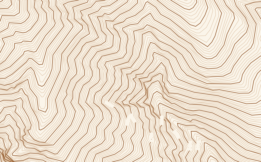
How to get contours into AutoCAD
Open the RoadDXF map and sign in free.
In the sidebar, switch on Export Contours in the orange Topo (Contours) box, just above Utility Poles (the buttons on this page switch it on for you), and pick the interval: 1, 2, 5 or 10 ft (0.5 to 5 m).
Search your site and draw a box, up to 2,500 ft on a side.
Press Generate DXF. The elevation download runs alongside the roads and parcels.
Open the DXF in AutoCAD: contours on TOPO-MAJOR and TOPO-MINOR, elevation labels on TOPO-LABELS.
What is in the drawing
- TOPO-MINOR: a contour at every interval. TOPO-MAJOR: every fifth one, with its elevation on TOPO-LABELS, turned to read along the line.
- One continuous polyline per contour at its real elevation (the polyline's Elevation property), closed where it closes inside the box, never broken for a label.
- The same coordinates as everything else in the export: NAD 83 State Plane in your state's legal foot (or meters), so contours, road edges and parcel lines line up, and the drawing opens on AutoCAD's map.
- Elevations in the drawing's unit: feet or meters, NAVD 88 in the US.
| Ground | Interval | Majors (labelled) |
|---|---|---|
| Flat lots and streets | 1 ft (0.5 m) | 5 ft (2.5 m) |
| Most subdivisions and roads | 2 ft (1 m) | 10 ft (5 m) |
| Hilly | 5 ft (2 m) | 25 ft (10 m) |
| Mountains, big rural boxes | 10 ft (5 m) | 50 ft (25 m) |
An elevation profile from Google Earth
Drew a route in Google Earth and want its profile in CAD? Save the path as a KML, drop it in the free KML to DXF converter and tick Ground elevations. You get the path in State Plane plus a profile drawing: stations, an elevation grid, the ground line at the exaggeration you pick, and the placemarks along the path (poles, for example) marked on it.
Common questions
Can Google Earth export contours or elevations?
No. Google Earth Pro shows the elevation under the cursor and an elevation profile along a path, but it has no export for terrain, contours or elevation data. RoadDXF gets the ground from the USGS 3D Elevation Program instead and draws the contours for you.
Where do the elevations come from?
In the US, from the USGS 3D Elevation Program (3DEP): bare earth, with buildings and trees removed, at 1 m where USGS has lidar and about 10 m elsewhere, in NAVD 88. Outside the US, from Terrain Tiles on AWS (mostly SRTM at about 30 m), above mean sea level.
Are the contours accurate enough for design?
They are good for planning, sketches, make-ready and base maps. They are not a survey: lidar is usually within a few inches to a foot in the open and less certain under trees and next to buildings. For grading, drainage or anything you stamp, use a topographic survey.
Why did my contour interval change?
A steep box at a fine interval would bury the drawing, so when one interval would give more than 250 contours the export steps up to the next round interval and says so in the result. A 2,500 ft box on a mountainside at 1 ft would otherwise hold thousands of lines.
Does Topo make exports slower?
Only when it is on, and it starts off. With Topo on, the elevation download runs alongside the roads and parcels and usually adds a few seconds.
Can I use the contours in Civil 3D?
Yes. Each contour is one polyline at its real elevation, so in Civil 3D you can create a TIN surface and add the TOPO-MAJOR and TOPO-MINOR polylines as contour data. Nothing needs retyping.
Contours, roads and parcels in one DXF
Topo rides along with the regular export: road edges and centerlines, property lines with APNs, addresses and buildings, all in the same coordinates. New accounts get 3 free exports every month, no credit card.